software development, cheese, aviation, and maps

Category: library

Audio books and ebooks

The fourth part of the world

The fourth part of the world: the race to the ends of the Earth, and the epic story of the map that gave America its name

A chronicle of the early sixteenth-century creation of the Waldseemüller map offers insight into how monks, classicists, merchants, and other contributors from earlier periods shaped the map’s creation.

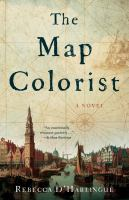
The map colorist

In 1660, Amsterdam is the trading and map-printing capital of the world. Anneke van Brug is one of the colorists paid to enhance black-and-white maps for a growing number of collectors. Her artistic talent brings her to the attention of the Blaeu printing house, and she begins to color for a rich merchant, Willem de Groot. But Anneke is not content to simply embellish the work of others; she longs to create maps of her own. Cartography, however, is the domain of men–so it is in secret that she borrows the notes her father made on a trip to Africa in 1642 and sets about designing a new map

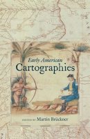
Early American Cartographies

Maps were at the heart of cultural life in the Americas from before colonization to the formation of modern nation-states. The fourteen essays in Early American Cartographies examine indigenous and European peoples’ creation and use of maps to better represent and understand the world they inhabited.

Drawing from both current historical interpretations and new interdisciplinary perspectives, this collection provides diverse approaches to understanding the multilayered exchanges that went into creating cartographic knowledge in and about the Americas.

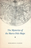
The Mysteries of the Marco Polo Maps

In the thirteenth century, Italian merchant and explorer Marco Polo traveled from Venice to the far reaches of Asia, a journey he chronicled in a narrative titled Il Milione, later known as The Travels of Marco Polo. While Polo’s writings would go on to inspire the likes of Christopher Columbus, scholars have long debated their veracity. Some have argued that Polo never even reached China-while others believe that he came as far as the Americas.

Now, there’s new evidence for this historical puzzle: a very curious collection of fourteen little-known maps and related documents said to have belonged to the family of Marco Polo himself.

Amerigo Vespucci: The Man Who Gave America Its Name

Keen to learn but short on time? Get to grips with the life of Amerigo Vespucci in next to no time with this concise guide.

50Minutes.com provides a clear and engaging analysis of the life and expeditions of Amerigo Vespucci. The 15th and 16th centuries were a key period for European naval exploration. While he was not the first man to set foot on American soil, the Florentine explorer Amerigo Vespucci was the first to realise that the landmass was a new continent, and made major contributions to navigation and cartography during the period.

Ptolemy’s Geography: An Annotated Translation of the Theoretical Chapters

Ptolemy’s Geography is the only book on cartography to have survived from the classical period and one of the most influential scientific works of all time. Written in the second century AD, for more than fifteen centuries it was the most detailed topography of Europe and Asia available and the best reference on how to gather data and draw maps. Ptolemy championed the use of astronomical observation and applied mathematics in determining geographical locations. But more importantly, he introduced the practice of writing down coordinates of latitude and longitude for every feature drawn on a world map, so that someone else possessing only the text of the Geography could reproduce Ptolemy’s map at any time, in whole or in part, at any scale.

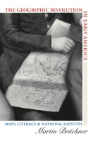
The Geographic Revolution in Early America: Maps, Literacy, and National Identity

The rapid rise in popularity of maps and geography handbooks in the eighteenth century ushered in a new geographic literacy among nonelite Americans. In a pathbreaking and richly illustrated examination of this transformation, Martin Bruckner argues that geographic literacy as it was played out in popular literary genres–written, for example, by William Byrd, George Washington, Thomas Jefferson, Royall Tyler, Charles Brockden Brown, Meriwether Lewis, and William Clark–significantly influenced the formation of identity in America from the 1680s to the 1820s.

Sea Monsters: The Lore and Legacy of Olaus Magnus’s Marine Map

Olaus Magnus’s 1539 Carta Marina can be considered the major source of Renaissance sea monster iconography and lore. The map and its voluminous commentary, History of the Northern Peoples, established Olaus as the innovative historian of the sea serpent, the giant squid and sea monsters in general.

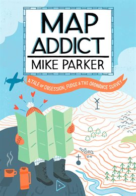
Map Addict

My name is Mike and I am a map addict. There, it’s said…’ Maps not only show the world, they help it turn. On an average day, we will consult some form of map approximately a dozen times, often without even noticing: checking the A-Z, the road atlas or the Sat Nav, scanning the tube or bus map, a quick Google online or hours wasted flying over a virtual Earth

Library of Congress

Maps to see:

Urbano Monte: 1587 World Map

Genovese (anon) 1457 world map

Olaus Magnus, 1527-1539, Nautical Chart and Description of the Northern Lands and Wonders

Honidus, 1631, Map of the World

Henry S. Tanner, 1826, A Map of the United States and Mexico

Johannes Vingboon, 1650, Map of California as an Island

Otto Lindberg and Ernest Alpers (Agloe), General Drafting Co., 1930’s, road map of New York State.

unknown Portuguese mapmaker, 1502, The Cantino Planisphere

Muhammad al-Idrisi, 1154, Tabula Rogeriana

Bellini, 1743, Riviere de l’ouest

the Bedolina Map

anything by: Johann Lambert

anything by: Gerardus Mercator

Fra Mauro map (1460) https://commons.wikimedia.org/wiki/File:FraMauroDetailedMap.jpg

The map of the world created by the astronomer and geographer Claudius Ptolemy (c. 100 – c. 170 CE). From a 15th-century book by Leinhart Holle. Made by the German cartographer Donnus Nicholas Germanus.

A map of Virginia, the area where English colonists settled in 1585 and 1587 CE, establishing Roanoke Colony (North Carolina, USA). The map also shows Florida and was made by John White (d. 1593 CE) in 1585 CE. (British Museum, London)

Books:

The Look of Maps: An Examination of Cartographic Design (Esri Press Classics) 1st Edition

Arthur H. Robinson

Designing Better Maps: A Guide for GIS Users 2nd Edition

Cynthia Brewer

Mapping: A Critical Introduction to Cartography and GIS 1st Edition

Jeremy W. Crampton

The Power of Maps Revised Edition

Denis Wood

Rethinking the Power of Maps 1st Edition

Denis Wood

QGIS Python Programming Cookbook

Joel Lawhead

https://www.packtpub.com/application-development/qgis-python-programming-cookbook/?utm_source=ACgislounge&utm_medium=referral&utm_campaign=1783984988

learn.arcgis.com:

Children’s books

Lindsey the GIS Specialist
Tyler Danielson
Bolton & Menk, Inc., 2019
online book: https://www.bolton-menk.com/books/lindsey/Lindsey.html

The next time a child asks you to explain what GIS is, you might want to read them this online book produced by engineering company Bolton & Menk. Entitled, “Lindsey the GIS Specialist”, the book is written by Tyler Danielson who is a GIS specialist with the company. Tyler wrote the book based on his sister, who also works in the GIS field.

The short book follows Lindsey, who works as a GIS specialist, as she explains what the acronym GIS means, the different types of GIS data, how she collects data, and what some of the maps she makes are used for.

Henry’s Map
David Elliot
Philomel Books, 2013
ISBN 978-0-399-16072-1
In a heartwarming tale about a wee little pig called Henry, kids will be taken on a whirlwind adventure around a barnyard as Henry tries to put all of his farm companions in order. Henry is quite a particular pig who likes rhythm and reason; when the barnyard becomes a messy disaster he takes his companions and your child on a trip to map out where they all belong. An easy read for young kinds, this understandable story will make them laugh and teach them a little something about maps along the way.

There’s a Map in my Lap!
Tish Rabe
Dr. Seuss Enterprises, LP 2002
Random House
ISBN 0-375-81099-4
A Doctor Seuss inspired story from the Cat in the Hat’s Learning Library, There’s a Map on my Lap! will give children a happy and rhyming introduction to how much fun maps can be. Written by Tish Rabe and illustrated in the style of Dr. Seuss’ famous characters by Aristides Ruiz, the short story follows a few adventuring friends as they follow a map together.

Mapmaking with Children: Sense of Place Education for the Elementary Years
David Sobel
Heinemann, A division of Reed Elsevier, Inc, 1998
ISBN-10: 0325000425
In Mapmaking with Children, kids and adults will go through a relatively easy elementary introduction to mapmaking and cartography. Kids will be able to place themselves in their own locations as well as learn about other parts of the world at the same time. This book explores the idea of building a child’s ‘sense of place’ throughout the elementary years accompanied by small project ideas and other tasks for kids to learn from.

Follow That Map!: A First Book of Mapping Skills (Exploring Our Community)
Scot Ritchie
Kids Can Press, 2009
ISBN 978-1-55453-274-2
teacher’s material: https://www.kidscanpress.com/sites/default/files/products/assets/FollowThatMap_2004_teaching.pdf
A First Book of Mapping Skills: Follow that Map! is a comprehensive picture book that allows kids to master not only getting from Point A to Point B, but to recognize certain map features no matter where they are in the world. A collection of likeable characters (both human and animal) waltz through the world finding out about new places and trying to find each other. Kids can search for each of the characters on each page and participate in interactive activities at the end of the book.

Me On The Map (Rise and Shine)
Alfredo Schifini
National Geographic Learning, 1996
ISBN 0-517-70095-6
Me on the Map by Joan Sweeney allows young kids to interact with a bright new world all on their own. The main character brings kinds into her colorful world by showing them a map of her bedroom, a map of her neighborhood, and a map of her home in the world to give perspective on how big the world is and how simply you can find your location in it. This picture book will give kids the skills to find their own location as they grow up and as they travel the world themselves.

Books to read

================================= General Maps

The Look of Maps: An Examination of Cartographic Design (Esri Press Classics) 1st Edition
Arthur H. Robinson

Originally published in 1952, The Look of Maps documents Arthur H.
Robinson’s pivotal observation that the discipline of cartography rests
at the crossroads of science and art. Based on his doctoral research,
this book attempts to resolve the apparent disconnect by covering a
range of topics related to the visual characteristics of cartographic
technique, including: lettering, structure, and color. Robinson offers
advice that even the modern cartographer will find relevant: adopt a
“healthy questioning attitude” in order to improve and refine the
graphic techniques used to present information visually through maps.
The Look of Maps is a classic text and an essential component to any
cartographic library.

Designing Better Maps: A Guide for GIS Users 2nd Edition
Cynthia Brewer

Designing Better Maps: A Guide for GIS Users, second edition, is a
comprehensive guide to creating maps that communicate effectively. In
Designing Better Maps, renowned cartographer Cynthia A. Brewer guides
readers through the basics of good cartography, including layout design,
scales, projections, color selection, font choices, and symbol
placement. Designing Better Maps also describes the author’s ColorBrewer
application, an online color selection tool. The second edition includes
a new chapter on map publishing.

Mapping: A Critical Introduction to Cartography and GIS 1st Edition
Jeremy W. Crampton

Mapping: A Critical Introduction to Cartography and GIS is an
introduction to the critical issues surrounding mapping and Geographic
Information Systems (GIS) across a wide range of disciplines for the
non-specialist reader.

  • Examines the key influences Geographic Information Systems (GIS) and
    cartography have on the study of geography and other related
    disciplines
  • Represents the first in-depth summary of the “new cartography” that
    has appeared since the early 1990s
  • Provides an explanation of what this new critical cartography is, why
    it is important, and how it is relevant to a broad, interdisciplinary
    set of readers
  • Presents theoretical discussion supplemented with real-world case
    studies
  • Brings together both a technical understanding of GIS and mapping as
    well as sensitivity to the importance of theory

The Power of Maps Revised Edition
Denis Wood

This volume ventures into terrain where even the most sophisticated map
fails to lead–through the mapmaker’s bias. Denis Wood shows how maps
are not impartial reference objects, but rather instruments of
communication, persuasion, and power. Like paintings, they express a
point of view. By connecting us to a reality that could not exist in the
absence of maps–a world of property lines and voting rights, taxation
districts and enterprise zones–they embody and project the interests of
their creators. Sampling the scope of maps available today,
illustrations include Peter Gould’s AIDS map, Tom Van Sant’s map of the
earth, U.S. Geological Survey maps, and a child’s drawing of the world.
THE POWER OF MAPS was published in conjunction with an exhibition at the
Cooper Hewitt Museum, the Smithsonian Institution’s National Museum of
Design.

Rethinking the Power of Maps 1st Edition
Denis Wood

A contemporary follow-up to the groundbreaking Power of Maps, this book
takes a fresh look at what maps do, whose interests they serve, and how
they can be used in surprising, creative, and radical ways. Denis Wood
describes how cartography facilitated the rise of the modern state and
how maps continue to embody and project the interests of their creators.
He demystifies the hidden assumptions of mapmaking and explores the
promises and limitations of diverse counter-mapping practices today.
Thought-provoking illustrations include U.S. Geological Survey maps;
electoral and transportation maps; and numerous examples of critical
cartography, participatory GIS, and map art.

================================= QGIS and Python

QGIS Python Programming Cookbook
Joel Lawhead
https://www.packtpub.com/application-development/qgis-python-programming-cookbook/?utm_source=ACgislounge&utm_medium=referral&utm_campaign=1783984988

QGIS Python Programming will teach you how to write Python code that
works with spatial data to automate geoprocessing tasks in QGIS. It will
cover topics such as querying and editing vector data and using raster
data. You will also learn to create, edit, and optimize a vector layer
for faster queries, reproject a vector layer, reduce the number of
vertices in a vector layer without losing critical data, and convert a
raster to a vector. Following this, you will come across recipes that
will help you to compose static maps, create heavily customized maps,
and add specialized labels and annotations. Apart from this, the book
will also share a few tips and tricks based on different aspects of this
powerful tool.

The PyQGIS Programmer’s Guide
Extending QGIS with Python
by Gary Sherman
http://locatepress.com/ppg

Welcome to the world of PyQGIS, the blending of Quantum GIS and Python to
extend and enhance your open source GIS toolbox. With PyQGIS you can write
scripts and plugins to implement new features and perform automated tasks.

This book will guide you in getting started with PyQGIS. After a brief
introduction to Python, you’ll learn how to understand the QGIS Application
Programmer Interface (API), write scripts, and build a plugin.

This book is designed to allow you to work through the examples as you go
along. At the end of each chapter you will find a set of exercises you can do
to enhance your learning experience.

The PyQGIS Programmer’s Guide is compatible with the version 2.0 API released
with QGIS 2.0.

The Genius of Birds
Author: Jennifer Ackerman; John Burgoyne, (Illustrator)
Publisher: New York : Penguin Books, 2017. ©2016
ISBN: 9781101980842 1101980842
OCLC Number: 1223042166

Disenchanted Night: The Industrialization of Light in the Nineteenth Century
Wolfgang Schivelbusch
Published by University of California Press, 1995
ISBN 10: 0520203542ISBN 13: 9780520203549

The Look of Maps: An Examination of Cartographic Design
Robinson, Arthur Howard
ISBN 9781589482623 (pbk. : alk. paper)
LC classification GA105 .R63 2010

The Mapmakers
Wilford, John Noble
ISBN 0394753038
LC classification GA105.3 .W493 1982

The geography behind history
W. Gordon East.
LC classification G141 .E2 1965

Flattening the Earth: Two Thousand Years of Map Projections
P. Snyder
Paperback, 384 pages
Published December 5th 1997 by University of Chicago Press (first published August 1st 1993)
ISBN 0226767477 (ISBN13: 9780226767475)
As long as there have been maps, cartographers have grappled with the impossibility of portraying the earth in two dimensions. To solve this problem mapmakers have created hundreds of map projections, mathematical methods for drawing the round earth on a flat surface. Yet of the hundreds of existing projections, and the infinite number that are theoretically possible, none is perfectly accurate.

Longitude : the true story of a lone genius who solved the greatest scientific problem of his time
by Sobel, Dava
Publication Date 1995
Call Number 526.62 SOB
ISBN 9780802713124 9780140258790

Adjustment Computations: Spatial Data Analysis, Fourth Edition
C. D. Ghilani and P. R. Wolf
© 2006 John Wiley & Sons, Inc.
ISBN: 978-0-471-69728-2

Mobility Data Management and Exploration
Authors: Pelekis, Nikos, Theodoridis, Yannis
ISBN 978-1-4939-0392-4
Integrates mobility data handling processes to meet real-world application requirements
https://www.springer.com/gp/book/97814939039

I think the GWU library has the first two:

all are from: https://www.google.com/search?hl=en&q=inauthor:%22Mark+Monmonier%22&tbm=bks

which was from: https://michaelminn.net/tutorials/gis-projections/index.html

=============================================

Air Apparent
How Meteorologists Learned to Map, Predict, and Dramatize Weather
By Mark Monmonier · 2019

ISBN: 9780226222875, 022622287X
Page count: 324
Published: January 18, 2019
Format: ebook
Publisher: University of Chicago Press
Language: English
Author: Mark Monmonier

=============================================

Drawing the Line
Tales of Maps and Cartocontroversy
By Mark S. Monmonier · 1995

ISBN: 9780805025811, 0805025812
Page count: 368
Published: 1995
Format: Hardcover
Publisher: H. Holt
Language: English
Author: Mark S. Monmonier

This book is an extension of Monmonier’s earlier book, How to lie with maps. As
powerful tools of persuasion in science and public affairs, maps have had a
remarkable effect on our view of the world, our health, and the impact of our
votes.

=============================================

Rhumb Lines and Map Wars
A Social History of the Mercator Projection

ISBN: 9780226534329, 0226534324

Published: November 15, 2010
Publisher: University of Chicago Press
Author: Mark Monmonier

https://www.google.com/books/edition/Rhumb_Lines_and_Map_Wars/nvwu4Ba_Qp0C?kptab=overview&gbpv=0#ba_cen=lat_e7:%20389451658%0Alng_e7:%203524345268%0A&ba_loc=20008

https://www.google.com/books/edition/Rhumb_Lines_and_Map_Wars/nvwu4Ba_Qp0C?hl=en&gbpv=0

=============================================

From Squaw Tit to Whorehouse Meadow
How Maps Name, Claim, and Inflame

By Mark Monmonier · 2008
ISBN: 9780226534640, 0226534642
Page count: 230
Published: September 15, 2008
Format: ebook
Publisher: University of Chicago Press
Language: English
Author: Mark Monmonier

https://www.google.com/books/edition/From_Squaw_Tit_to_Whorehouse_Meadow/8DyZWTwkfF0C?hl=en&gbpv=0

================================

Adventures in Academic Cartography
A Memoir
By Mark Monmonier · 2016

ISBN: 9781523254316, 1523254319
Page count: 320
Published: January 27, 2016
Format: Paperback
Publisher: CreateSpace Independent Publishing Platform
Language: English
Author: Mark Monmonier

===============================================

Connections and Content
Reflections on Networks and the History of Cartography
By Mark S. Monmonier · 2019

ISBN: 9781589485594, 1589485599
Page count: 275
Published: 2019
Format: Paperback
Publisher: Esri Press
Language: English
Author: Mark S. Monmonier
Books

-> Open Resource

Mapping the Future: Cartography makes a comeback. By: Jancer, Matt, Wired, 10591028, Nov2017, Vol. 25, Issue 11

The Mapmaker’s Mystery By: Rehmeyer, Julie, Discover, 02747529, Jun2014, Vol. 35, Issue 5

Cosmic cartography By: Campanella, Emanuela, Canadian Geographic, 07062168, 2019 Special Issue

I know where you are right now By: M. S., M. B., New Scientist, 02624079, 7/3/2010, Vol. 206, Issue 2767

Game for mapping By: Kylie, Aaron, Canadian Geographic, 07062168, Jul/Aug2019, Vol. 139, Issue 4

What’s wrong with this picture? By: Dorling, Danny, Barford, Anna, New Scientist, 02624079, 5/6/2006, Vol. 190, Issue 2550

Montgomery County Public Library notes

some notes about the Montgomery County Public Library

Library Links and notes ebsco ebooks ; library card and password needed

Montgomery County Interlibrary loan ; run by OCLC

worldcat.org run by OCLC

Marina – free method of requesting books from MD library; interlibrary loan; will cancel after 6 months if they can’t find a loan for you

Sailor is a project of Maryland’s public libraries that provides broadband Internet access for public libraries, schools and local government in Maryland, and an extensive collection of research databases for the use of Maryland public library customers.

MD state archival materials

OCLC Online Computer Library Center is a nonprofit membership organization that promotes cooperation among libraries worldwide. More than 54,000 libraries in 109 countries use OCLC services to locate, acquire, catalog, lend and preserve print and electronic library materials.

Find out about databases at MCPL


Science Reference Center

MCPL

to get to Marina from MCPL
-> Library Home Page
-> Services .. Reader Services .. Marina & Inter Library Loan
-> You can request materials through Marina
Library Card: ^V  (to paste)
-> My Account
-> Open Requests

Science Reference Center – EBSCO:

-> Research & Learn
-> Science
-> Science Reference Center
-> Open Resource

© 2025 Wendell's stuff

Theme by Anders NorenUp ↑